ToolPotion
AI Advisor
Submit a Tool (Free)

whereisthis.place

whereisthis.place finds where a photo was taken using free in-browser EXIF GPS extraction plus AI geolocation that returns ranked location predictions, built privacy-first for OSINT and research.

Visit Website
Share
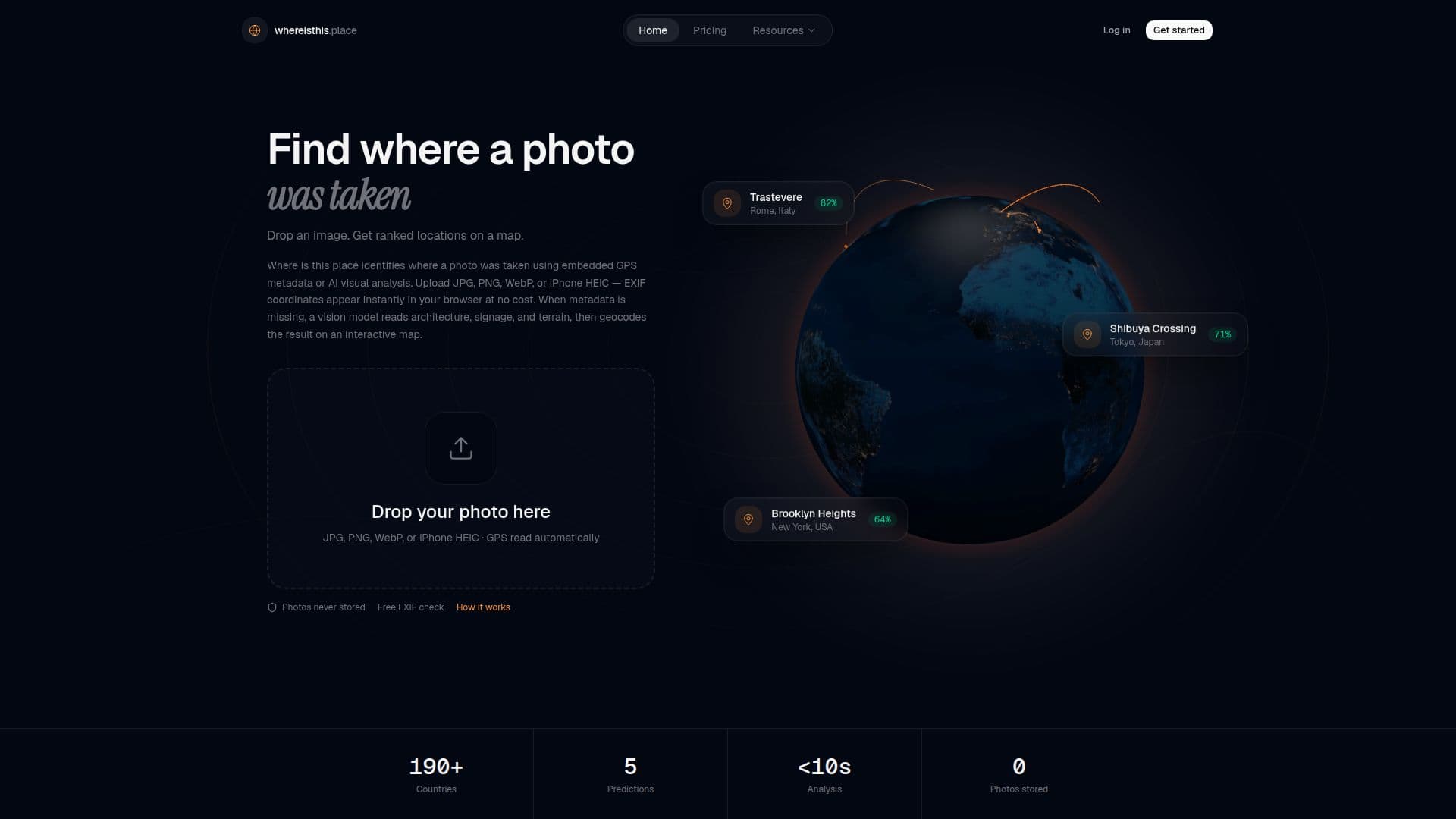
whereisthis.place screenshot

whereisthis.place is a photo geolocation tool that helps determine where a picture was taken. It offers two paths from a single upload: free EXIF GPS extraction read locally in the browser, and AI geolocation that infers location from visual cues when metadata is absent. It is built privacy-first and designed for places, not people, with no facial recognition or identity lookup.

Read More

When a photo contains GPS in its EXIF metadata, whereisthis.place shows the location instantly in the browser with no server cost and no credit charge. When GPS is missing, its vision model analyzes cues like architecture, signage, vegetation, terrain, and road markings to return up to five ranked location predictions with confidence scores, which are then resolved to place names via OpenStreetMap geocoding and shown on a map. It supports JPG, JPEG, PNG, WebP, and iPhone HEIC, and processes images in memory without retaining the originals; logged-in users see only a thumbnail and result JSON in search history.

EXIF extraction is always free with no account, and new accounts receive one free AI search credit on signup. Additional AI searches use wallet credits that never expire or a Pro subscription with monthly credits and priority processing, with enterprise options available on request. The tool is aimed at OSINT researchers, journalists, and photographers who need transparent, ranked location intelligence for verification and research.

  • CategoryComputer Vision Tools
  • Pricing ModelFreemium
  • DeploymentCloud
  • PlatformsWeb

  • Free in-browser EXIF GPS extraction

  • AI geolocation from visual scene cues

  • Up to five ranked predictions with confidence scores

  • OpenStreetMap geocoding to place names

  • Results shown on an interactive map

  • Support for JPG, PNG, WebP, and iPhone HEIC

  • Privacy-first: images processed in memory and discarded

  • Built for places, not facial recognition

  1. Upload: Drop any photo; EXIF GPS is checked free in your browser.

  2. Analyze: If GPS is missing, run AI analysis of the scene's visual cues.

  3. Locate: Review up to five ranked location predictions on a map.

  • OSINT verification
  • Journalism
  • EXIF GPS lookup
  • Travel and photography

whereisthis.place Reviews

Loading...

Popular AI Tools Like whereisthis.place

Picarta

AI Apps

Picarta uses AI to find the exact location of any photo. Upload an image to discover its GPS coordinates, city, and country by analyzing visual clues like architecture,…

Computer Vision Tools

Ranked #42 for Journalists

View Tool

AI Apps

Uses AI to find the exact location of any photo. Upload an image to discover its GPS coordinates, city, and country by analyzing visual clues like architecture,…Picarta uses AI to find the exact location of any photo. Upload an image to discover its GPS coordinates, city, and country by analyzing visual clues like architecture,…

Computer Vision Tools
Ranked #42 for Journalists

Lenso.ai offers AI-powered reverse image search for finding places, people, and duplicate images. Utilize facial recognition to track your digital footprint or find copyright…

Computer Vision Tools

Ranked #30 in AI Search Engines

View Tool

Offers AI-powered reverse image search for finding places, people, and duplicate images. Utilize facial recognition to track your digital footprint or find copyright…Lenso.ai offers AI-powered reverse image search for finding places, people, and duplicate images. Utilize facial recognition to track your digital footprint or find copyright…

Computer Vision Tools
Ranked #30 in AI Search Engines

Siuu.AI

AI Apps

Siuu.AI is an AR-GenAI platform that connects users with local and global places for real-time information. It acts as a smart guide, allowing users to chat with locations and…

Lifestyle & TravelTravel & Hospitality
View Tool

AI Apps

AR-GenAI platform that connects users with local and global places for real-time information. It acts as a smart guide, allowing users to chat with locations and…Siuu.AI is an AR-GenAI platform that connects users with local and global places for real-time information. It acts as a smart guide, allowing users to chat with locations and…

Lifestyle & TravelTravel & Hospitality
See the Top 250 AI Apps

A reality capture platform combining drone mapping, 360 photo documentation, robotics, and AI to help enterprises track construction, energy, and agriculture site progress,…

Computer Vision ToolsReal Estate & Construction

Ranked #1 in Energy & Utilities

View Tool

A reality capture platform combining drone mapping, 360 photo documentation, robotics, and AI to help enterprises track construction, energy, and agriculture site progress,…

Computer Vision ToolsReal Estate & Construction
Ranked #1 in Energy & Utilities

Flypix AI

AI Apps

Flypix AI offers AI-powered geospatial solutions for analyzing satellite, aerial, and drone imagery. It automates detection, monitoring, and inspection tasks, saving users…

Computer Vision Tools

Ranked #83 in Computer Vision Tools

View Tool

AI Apps

Offers AI-powered geospatial solutions for analyzing satellite, aerial, and drone imagery. It automates detection, monitoring, and inspection tasks, saving users…Flypix AI offers AI-powered geospatial solutions for analyzing satellite, aerial, and drone imagery. It automates detection, monitoring, and inspection tasks, saving users…

Computer Vision Tools
Ranked #83 in Computer Vision Tools

OpalAi offers Spatial AI tools that transform diverse data, including spatial, visual, textual, and audio, into actionable insights. Designed for commercial and government use in…

Computer Vision ToolsGovernment & Public Sector

Ranked #106 in Computer Vision Tools

View Tool

Offers Spatial AI tools that transform diverse data, including spatial, visual, textual, and audio, into actionable insights. Designed for commercial and government use in…OpalAi offers Spatial AI tools that transform diverse data, including spatial, visual, textual, and audio, into actionable insights. Designed for commercial and government use in…

Computer Vision ToolsGovernment & Public Sector
Ranked #106 in Computer Vision Tools

This AI experiment uses Google Vision API to analyze uploaded photos, revealing the private information an AI can infer about you. Upload an image and discover what data is…

AI Privacy Tools
View Tool

This AI experiment uses Google Vision API to analyze uploaded photos, revealing the private information an AI can infer about you. Upload an image and discover what data is…

AI Privacy Tools
See the Top 250 AI Apps

LocaleScan is an innovative platform that provides detailed overviews of areas surrounding real estate properties. It uses AI and cutting-edge tools to offer interactive maps,…

AI Data AnalysisReal Estate & Construction
View Tool

Innovative platform that provides detailed overviews of areas surrounding real estate properties. It uses AI and cutting-edge tools to offer interactive maps,…LocaleScan is an innovative platform that provides detailed overviews of areas surrounding real estate properties. It uses AI and cutting-edge tools to offer interactive maps,…

AI Data AnalysisReal Estate & Construction
See the Top 250 AI Apps
1 of 8