
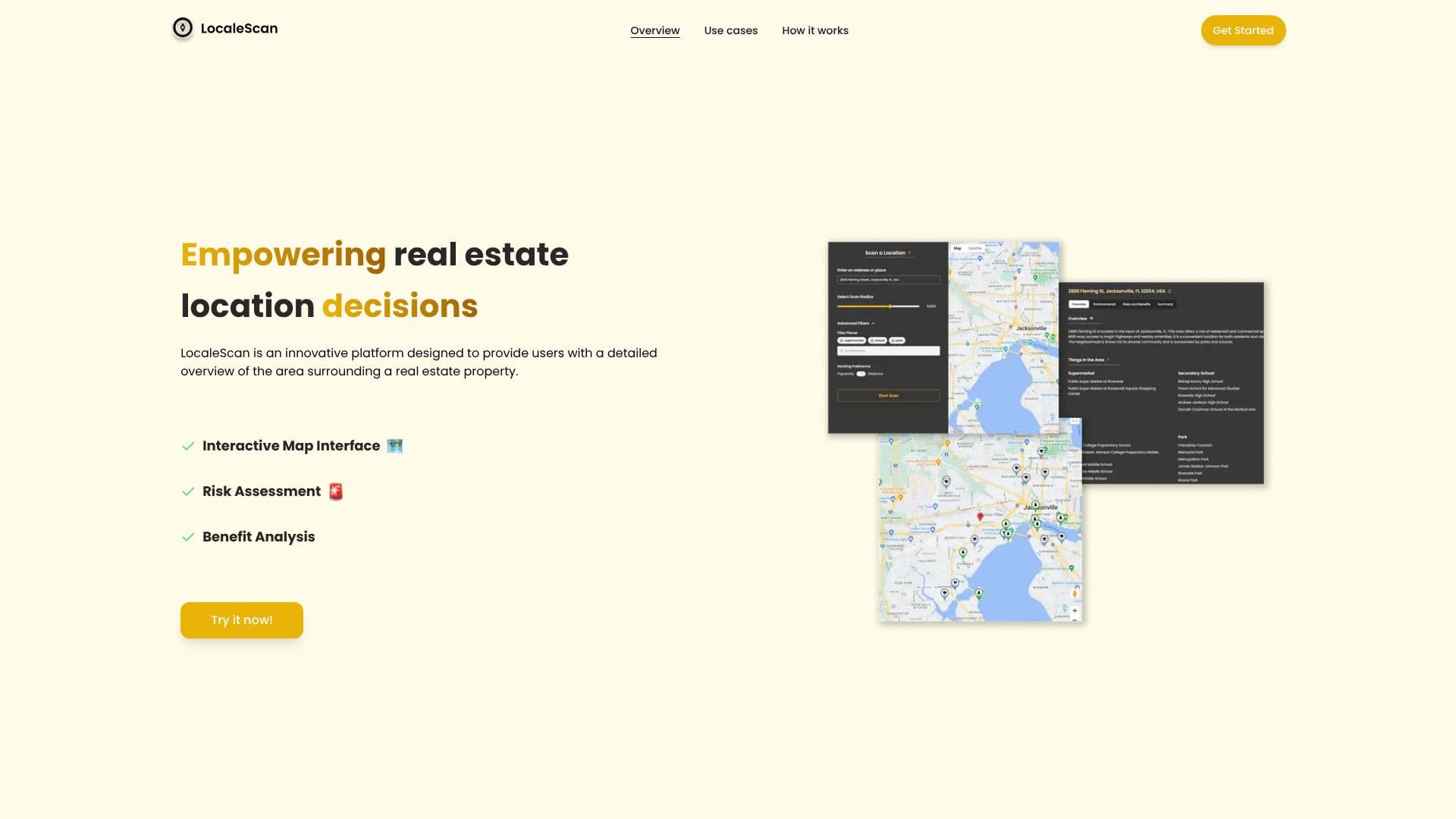
Description
LocaleScan is an innovative platform designed to empower users with comprehensive insights into the areas surrounding real estate properties, thereby enhancing property location decisions. By leveraging cutting-edge tools and artificial intelligence, LocaleScan helps individuals navigate property prospects with increased confidence.
Read More
The platform features an interactive map interface that allows users to explore detailed information about a property's surroundings. This map includes customizable markers representing various points of interest such as educational institutions and medical facilities. Users can zoom in and out to get a granular view of the area.
LocaleScan offers a robust Risk Assessment module, providing up-to-date statistics on crime rates, environmental hazards like noise and pollution levels, proximity to highways and industrial sites, and an evaluation of the area's economic stability, including unemployment rates and growth opportunities.
The Benefit Analysis component highlights local amenities, showcasing nearby restaurants, cafes, bars, shopping centers, gyms, entertainment venues, supermarkets, and grocery stores to emphasize convenience and lifestyle options. It also details educational and childcare facilities, including public and private schools, colleges, and daycare centers, to assess educational opportunities.
LocaleScan serves a diverse range of users. Homebuyers can assess the safety, convenience, and suitability of neighborhoods before purchasing. Renters can evaluate the pros and cons of different rental properties based on their location. Real estate investors can identify high-potential investment areas and avoid locations with significant risks. Real estate agents can provide clients with detailed, data-driven insights. Urban planners and developers can understand existing conditions and potential challenges of development sites.
The process is straightforward: users specify a location to analyze, define a scan radius, and then receive comprehensive results. LocaleScan aims to simplify complex location analysis, making real estate decisions more informed and precise.
- CategoryAI Data Analysis
- DeploymentCloud
- PlatformsWeb
LocaleScan's Core Features
Interactive map interface for exploring property surroundings
Customizable markers for various points of interest
Crime rate statistics for risk assessment
Environmental hazard details including noise and pollution levels
Economic stability evaluation with unemployment rates and growth opportunities
Local amenity listings for convenience and lifestyle assessment
Information on educational and childcare facilities
AI-powered analysis for property location decisions
Customizable scan radius for detailed area analysis
Data-driven insights for real estate professionals and buyers
How to use LocaleScan?
Specify Location: Enter the address or area you wish to analyze.
Define Radius: Set the desired radius for the location scan.
Analyze Results: Review the detailed map, risk assessment, and benefit analysis.
Make Decisions: Use the insights to inform your real estate choices.
LocaleScan's Use Cases
- Home Buyer Analysis
- Rental Property Evaluation
- Investment Area Identification
- Agent Client Insights
- Development Site Assessment
- Lifestyle Convenience Check
- Educational Opportunity Review