
ToolPotion
AI Advisor
Submit a Tool (Free)

iris R&D Group

Iris Roads leverages AI and computer vision to automate road and roadway asset maintenance. It provides insights for efficient asset management, compliance with standards, and community safety. The solution includes specialized cameras and a flexible dashboard for data collection and analysis, prioritizing privacy with automated redaction.

Visit Website
Share
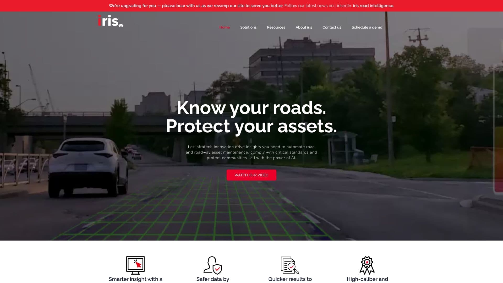
iris R&D Group screenshot

Iris Roads offers an AI-powered infratech solution designed to automate road and roadway asset maintenance, enhance insights, and ensure compliance with critical standards. By utilizing artificial intelligence and computer vision, the platform drives efficiency in managing road infrastructure and protecting communities. The end-to-end solution comprises specialized cameras, a flexible dashboard, and an app, creating a smart ecosystem for road patrolling and asset data collection.

Read More

Privacy is a key consideration, with automated image redaction safeguarding public data. Iris Roads delivers reliable, first-party data tailored to the operational needs of various departments. This approach empowers both public and private sectors to execute maintenance tasks more efficiently, leading to reduced operational costs while adhering to regulatory standards. The company is recognized as an award-winning infratech solution provider, offering high-quality data, user-friendly tools, and valuable expertise.

Key capabilities include automated road patrol for monitoring and repairing defects like potholes and cracks, and detecting up to 300 damaged or missing roadway assets such as traffic signs, street lights, and pavement markings. The platform also facilitates Pavement Condition Index (PCI) surveys to evaluate pavement health and identify distresses. Furthermore, it enables the capture and inventory of roadway assets, including their attributes like sign codes, street names, and asset size. The system is designed to be trusted and system-ready, with components like the irisGO camera and irisCITY dashboard, which can integrate with existing work order management systems and ERPs.

Iris Roads aims to modernize road maintenance, making roads safer and extending the life of road infrastructure. The solution has been adopted by various municipalities, demonstrating its effectiveness in improving service levels, complying with legislation, saving costs, and enhancing safety. Case studies highlight significant improvements, such as reduced pavement inspection time and increased accuracy in compliance reporting.

  • CategoryComputer Vision Tools
  • DeploymentCloud
  • PlatformsWeb

  • Automated road patrolling for defect detection

  • Detection of up to 300 roadway asset types

  • Pavement Condition Index (PCI) survey capabilities

  • Roadway asset inventory and attribute capture

  • AI-driven data visualization dashboard (irisCITY)

  • AI-enabled dash camera (irisGO)

  • Automated image redaction for privacy

  • Integration with existing work order management systems and ERPs

  • Compliance with regulatory standards

  • Cost reduction through efficient maintenance execution

  • Improved road safety and infrastructure longevity

  1. Deploy irisGO cameras on patrol vehicles or static locations.

  2. Utilize the irisCITY dashboard for data visualization and analysis.

  3. Configure integrations with existing work order management systems.

  4. Monitor road conditions and asset status through the platform.

  5. Generate reports for compliance and operational planning.

  6. Execute timely maintenance based on AI-driven insights.

  • Automated Road Defect Detection
  • Roadway Asset Inventory
  • Pavement Condition Assessment
  • Compliance Reporting
  • Infrastructure Maintenance Planning
  • Public Safety Enhancement
  • Cost Reduction in Maintenance

iris R&D Group Reviews

Loading...

Popular AI Tools Like iris R&D Group

Currux Vision provides autonomous AI systems for smart infrastructure, focusing on cities, DoTs, and government agencies. Their solutions monitor, optimize, and monetize complex…

Computer Vision ToolsGovernment & Public Sector

Ranked #118 in Computer Vision Tools

View Tool

Provides autonomous AI systems for smart infrastructure, focusing on cities, DoTs, and government agencies. Their solutions monitor, optimize, and monetize complex…Currux Vision provides autonomous AI systems for smart infrastructure, focusing on cities, DoTs, and government agencies. Their solutions monitor, optimize, and monetize complex…

Computer Vision ToolsGovernment & Public Sector
Ranked #118 in Computer Vision Tools

Rekor leverages AI to collect, connect, and organize global mobility data, delivering actionable roadway intelligence. Their patented technology transforms data into insights for…

Computer Vision ToolsAutomotive

Ranked #33 in Automotive

View Tool

Leverages AI to collect, connect, and organize global mobility data, delivering actionable roadway intelligence. Their patented technology transforms data into insights for…Rekor leverages AI to collect, connect, and organize global mobility data, delivering actionable roadway intelligence. Their patented technology transforms data into insights for…

Computer Vision ToolsAutomotive
Ranked #33 in Automotive

LensLink

AI Apps

LensLink offers advanced AI and IoT solutions powered by leading face recognition and action analysis algorithms. Their systems are designed for various applications, including…

Computer Vision ToolsRetail & Consumer Goods

Ranked #139 in Computer Vision Tools

View Tool

AI Apps

Offers advanced AI and IoT solutions powered by leading face recognition and action analysis algorithms. Their systems are designed for various applications, including…LensLink offers advanced AI and IoT solutions powered by leading face recognition and action analysis algorithms. Their systems are designed for various applications, including…

Computer Vision ToolsRetail & Consumer Goods
Ranked #139 in Computer Vision Tools

Samsara Intelligence provides AI insights to enhance safety, reduce errors, and cut costs in connected operations. It leverages a vast data set to deliver real-time fleet…

Computer Vision ToolsAutomotive
View Tool

Provides AI insights to enhance safety, reduce errors, and cut costs in connected operations. It leverages a vast data set to deliver real-time fleet…Samsara Intelligence provides AI insights to enhance safety, reduce errors, and cut costs in connected operations. It leverages a vast data set to deliver real-time fleet…

Computer Vision ToolsAutomotive
See the Top 150 AI Platforms

OpalAi offers Spatial AI tools that transform diverse data, including spatial, visual, textual, and audio, into actionable insights. Designed for commercial and government use in…

Computer Vision ToolsGovernment & Public Sector

Ranked #105 in Computer Vision Tools

View Tool

Offers Spatial AI tools that transform diverse data, including spatial, visual, textual, and audio, into actionable insights. Designed for commercial and government use in…OpalAi offers Spatial AI tools that transform diverse data, including spatial, visual, textual, and audio, into actionable insights. Designed for commercial and government use in…

Computer Vision ToolsGovernment & Public Sector
Ranked #105 in Computer Vision Tools

OpenSpace

AI Apps

OpenSpace is a Visual Intelligence Platform designed for construction teams. It transforms jobsite imagery into actionable insights, enabling faster and better decision-making.…

Computer Vision ToolsReal Estate & Construction

Ranked #12 for Project Managers

View Tool

AI Apps

Visual Intelligence Platform designed for construction teams. It transforms jobsite imagery into actionable insights, enabling faster and better decision-making.…OpenSpace is a Visual Intelligence Platform designed for construction teams. It transforms jobsite imagery into actionable insights, enabling faster and better decision-making.…

Computer Vision ToolsReal Estate & Construction
Ranked #12 for Project Managers

A reality capture platform combining drone mapping, 360 photo documentation, robotics, and AI to help enterprises track construction, energy, and agriculture site progress,…

Computer Vision ToolsReal Estate & Construction

Ranked #2 in Energy & Utilities

View Tool

A reality capture platform combining drone mapping, 360 photo documentation, robotics, and AI to help enterprises track construction, energy, and agriculture site progress,…

Computer Vision ToolsReal Estate & Construction
Ranked #2 in Energy & Utilities

Visage Technologies offers custom AI and ML solutions with over 20 years of experience. They specialize in efficient, high-accuracy edge AI development, from planning and data…

Computer Vision ToolsHealthcare & Life Sciences

Ranked #34 in Automotive

View Tool

Offers custom AI and ML solutions with over 20 years of experience. They specialize in efficient, high-accuracy edge AI development, from planning and data…Visage Technologies offers custom AI and ML solutions with over 20 years of experience. They specialize in efficient, high-accuracy edge AI development, from planning and data…

Computer Vision ToolsHealthcare & Life Sciences
Ranked #34 in Automotive
1 of 8